Here is a map, found from the Walla Walla Public Works Department, which shows all the different locations of stormwater collection in Walla Walla.

In contrast, here is a map of Walla Walla, with Mill Creek highlighted.
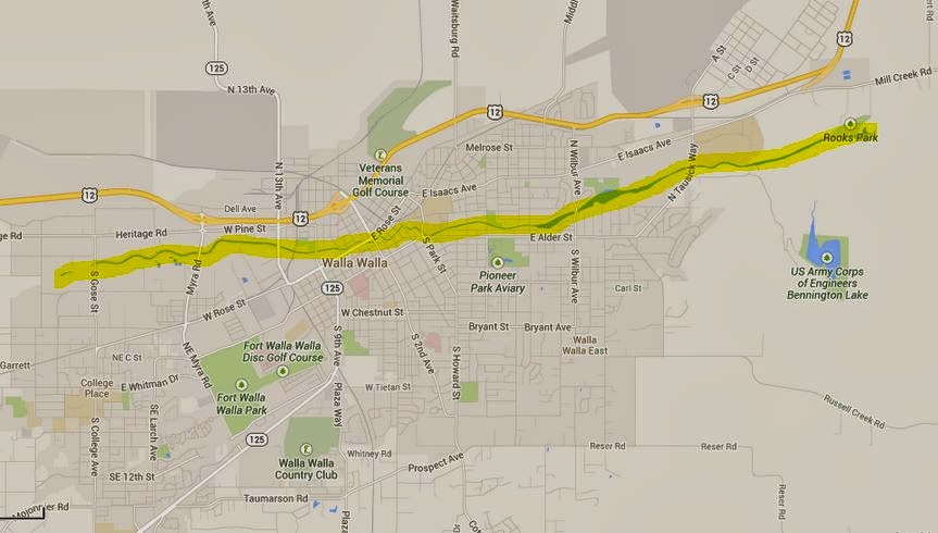
It is certainly beneficial that Walla Walla has established so many different conveyance systems for the stormwater, but it is also causing a problem because there are none of these systems for collection close to Mill Creek.
The possible reason for this is tying back to my ideas regarding distribution of wealth in Walla Walla. When discussing labeling the storm drains to show that they go to the water sources, I hypothesized that the labels were only in a certain area because they could afford to put them up. This same area, south of the Whitman College campus, is the same area that, according to the first map, has a huge portion of the stormwater conveyance systems. Is it, once again, because they can afford them?
None of the stormwater collection or filtration service are in play on Mill Creek until downstream of town. Mill Creek, known for its contamination, should have more of these throughout Walla Walla.
Sources:
Walla Walla Public Works Department, (2011). Walla walla county stormwater operations and maintenance plan . Retrieved from website: http://wwcountyroads.com/Docs/Stormwater-operations-Maintenance-Plan.pdf
No comments:
Post a Comment